How to Determine Weather for Diving
Introduction
Whenever planning a dive, one of our primary concerns is the condition of the sea at the time of immersion. Our favorite hobby takes place outdoors and within the marine environment, making us heavily reliant on meteorology to successfully conduct our dives.
In my opinion, extensively planning a dive and neglecting a proper interpretation of the expected weather for that day is futile. Weather conditions could necessitate a postponement of the dive, and it’s important to ascertain this with the utmost certainty possible.
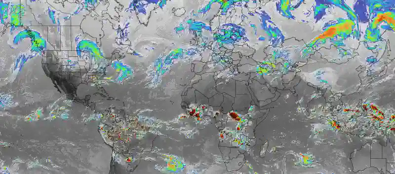
Certainly, most of us have one way or another to check the sea conditions for our dives. Due to my interest in the subject, I’ve always inquired, and in almost all cases, I’ve observed the use of mobile weather applications. These apps provide data on waves, wind, etc., are very convenient, free, and always available. However, in this post, I’ll focus on other, slightly more hidden yet equally useful sources that can significantly aid us in this task.
I’ll concentrate on data that I haven’t seen anyone using, which I can contribute to the diving community. Towards the end of this post, I’ll discuss conventional apps and some hidden improvements we can utilize to interpret and make an enhanced forecast.
Meteorological Factors to Consider
To make a proper plan, we should have a computer in front of us and observe various weather factors relevant to diving. Here they are listed, and for all of them, we need to know the geographical point of the dive and the date, as we must check the prediction for that specific place and time.
Significant Wave Height
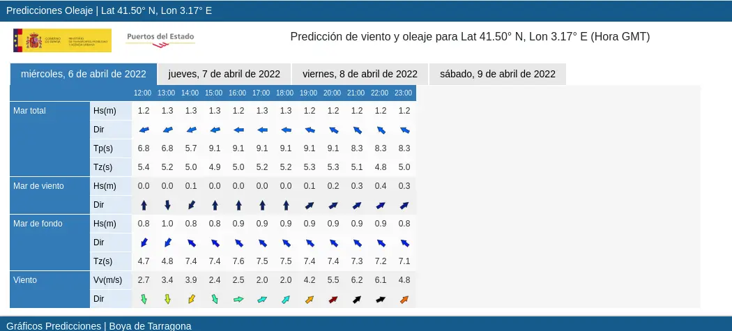
In my opinion, this is the decisive variable determining the feasibility of the dive, requiring the utmost precision in prediction at that point. For this, in the Iberian Peninsula, I use the meteorological model generated by Puertos del Estado. This model uses wind predictions from AEMET’s HARMONIE and HRES-ECMWF for forecasts beyond 48 hours. Additionally, it provides data from observations of several buoys installed near ports, significantly improving the model’s accuracy in those areas.
For instance, if we want to know about the waves at the Dragonera wreck, located in the port of Tarragona, we could observe the model and its predictive quality at that specific point.
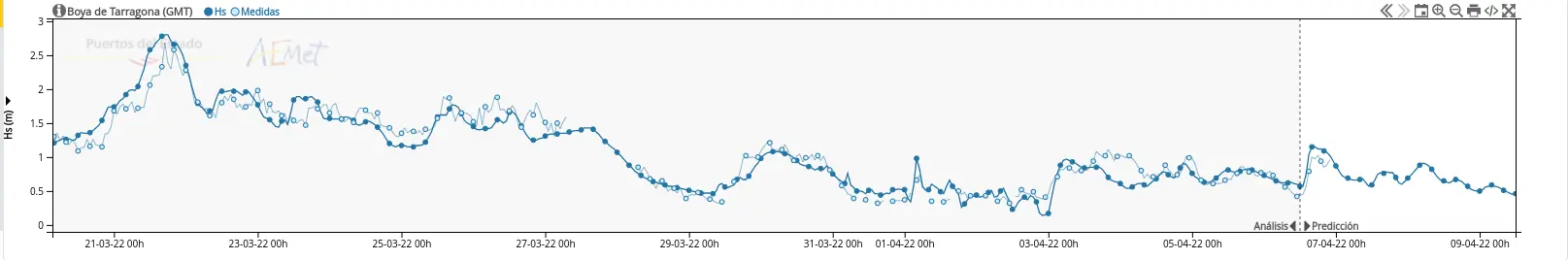
Luckily for the Dragonera wreck, we have observations from a buoy recording hourly granularity of wave height. There are several other points, always buoys aiding wave prediction in the ports, as we are more concerned about waves in port areas than in diving areas.
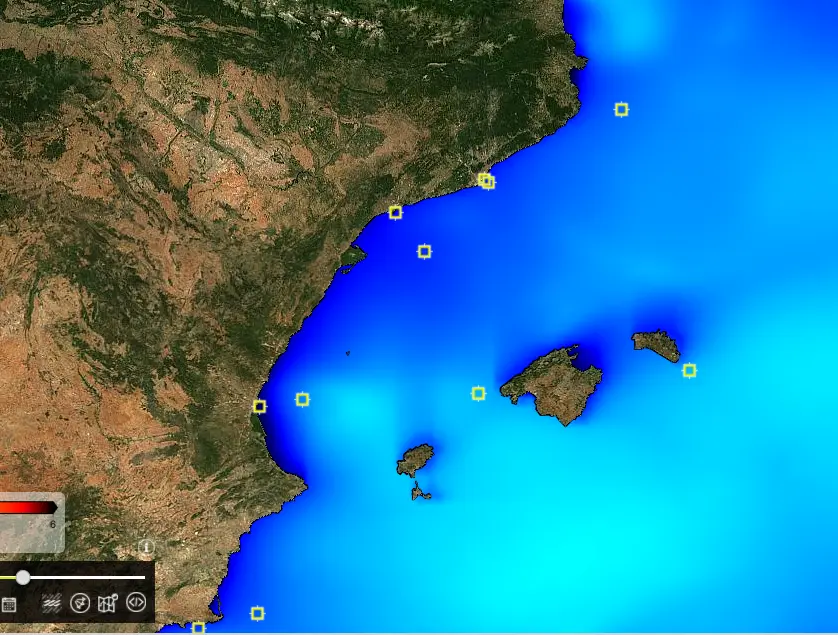
This doesn’t mean we have to manually interpolate the prediction at the desired point; the model itself provides a prediction across its grid points. Thus, we can check the prediction for our point.
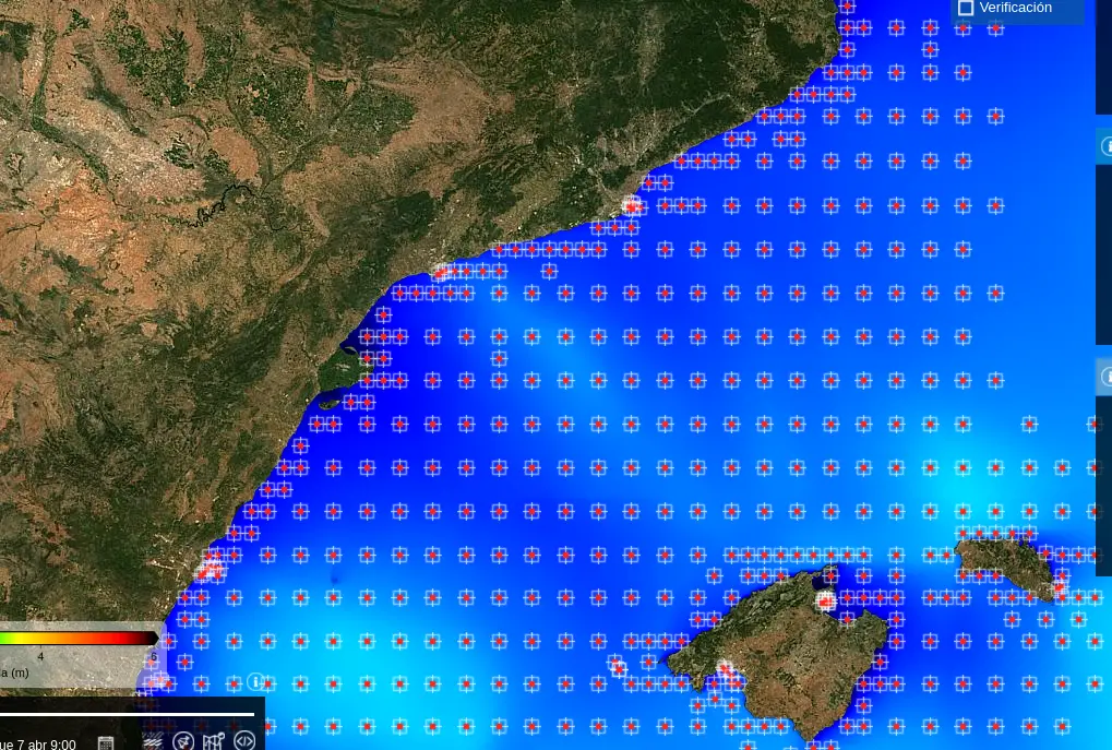
When we check a point, we can see the data in a table format for all variables in the model, not just significant height. We can also view wave period and direction, the component of swell or wind that affects the wave, etc. Additionally, there are wind data at that point, which could be useful for understanding local winds and the sea state through another experienced observer’s perspective.
Moreover, Copernicus provides this WAN model without being improved by AEMET’s HARMONIE.
Water Temperature
This variable significantly affects diving, but it’s not predicted as such since it’s quite easy to deduce the temperature based on the time of year and past observations for that date.
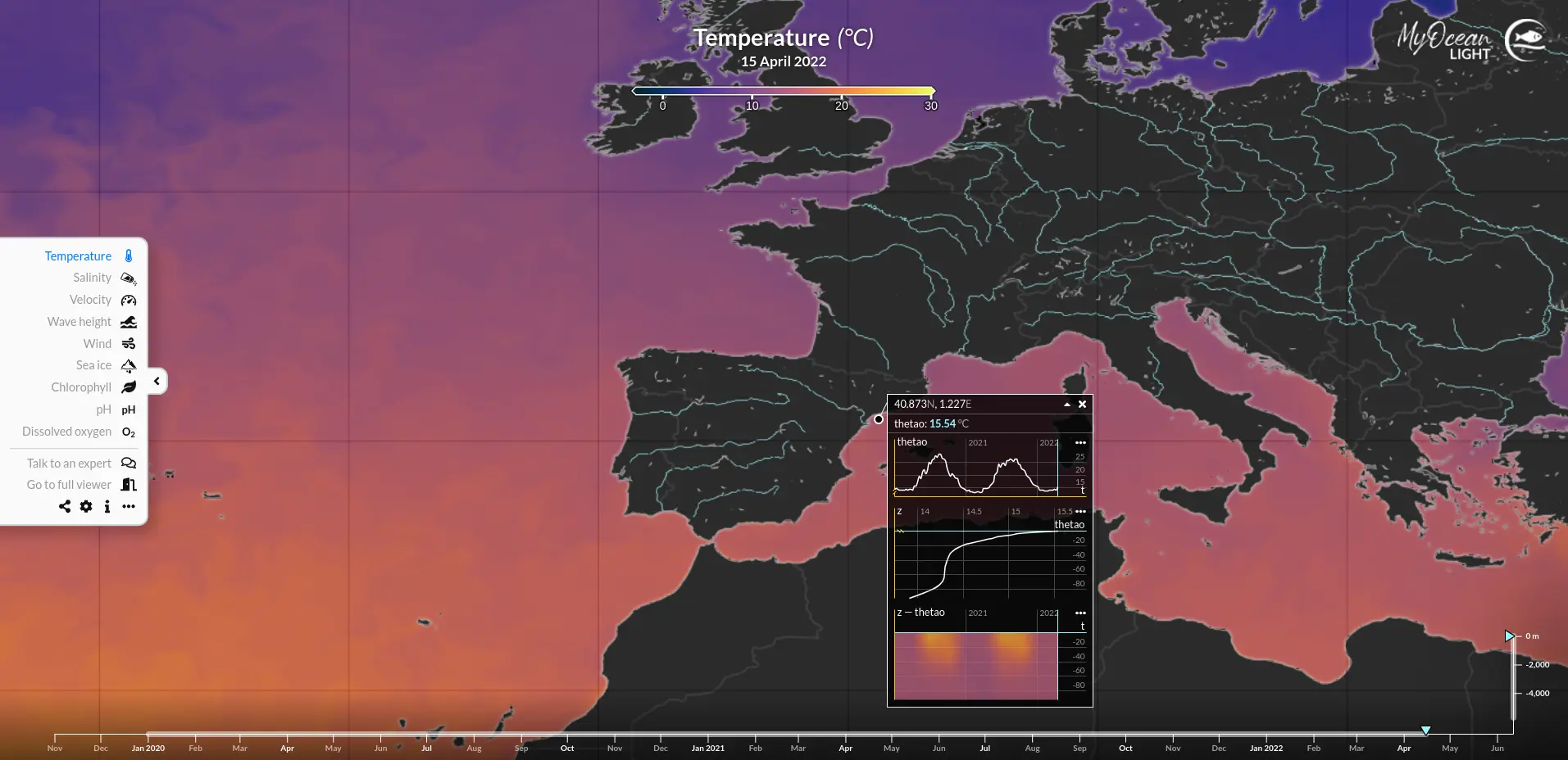
In Copernicus, we can check the temperature prediction at our ocean point and access a history of the analyzed model.
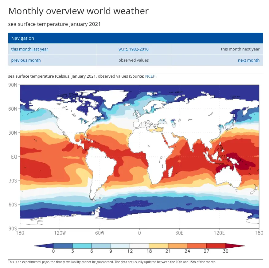
Here, I’d like to offer another source quite useful for diving trips, where we want to know the temperature at a point on the planet beyond our experience and latitudes. WMO allows us to explore the average temperature of a month at any point on the planet. It might not be precise, but it can assist in planning a trip, considering the date and destination.
Additionally, NASA has a mission called MUR that measures global sea temperature, viewable using NASA’s worldview tool.
Current
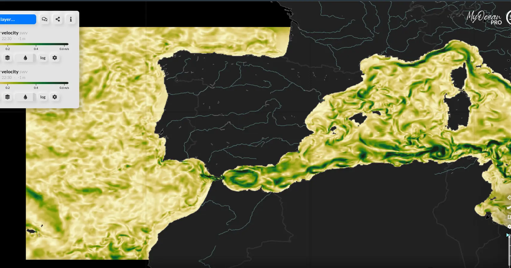
This variable also affects diving. What diver hasn’t dreamt of knowing the days without a current at that incredible wreck? However, I’ve studied this variable less up to now. I see a data point for water speed in the horizontal plane, but I haven’t yet comprehended which vertical levels are used for measurement and/or prediction.
In Copernicus, we can view current data in various datasets, and this variable is available on Windy too. I haven’t had the chance to repeat dives enough to verify its usefulness personally, but it would be great to do so.
Rain and Wind
While it’s advisable to check these variables, I consider them less critical, although they could lead to others like visibility that are of interest to us. By studying past days of rain and storms, we can deduce good or bad visibility, for instance.
We can also plan for scenarios like sailing, or if carrying dive equipment requires us to be out in the rain, or any other more eccentric reasons these variables might affect us. In any case, for these, I refer to the next section on conventional apps.
The Conventional Route
To check the weather at a point, we’ll use the application Windy, among others available, but this app is becoming quite popular among users due to its variety of layers, models, and data.
For a serious plan, I recommend using a PC instead of a mobile device if possible. There, we can make use of the entire application interface. We can view information on all previously described variables, sacrificing a bit of precision at the point but gaining the ability to predict in any part of the planet, not just the Iberian Peninsula.
Apart from checking waves here, we can also explore “what the day will be like” in general (temperature, rain, and wind). Instead of simply opening the app and checking the initial prediction it provides, I recommend a multimodel view of these variables. Here’s how:
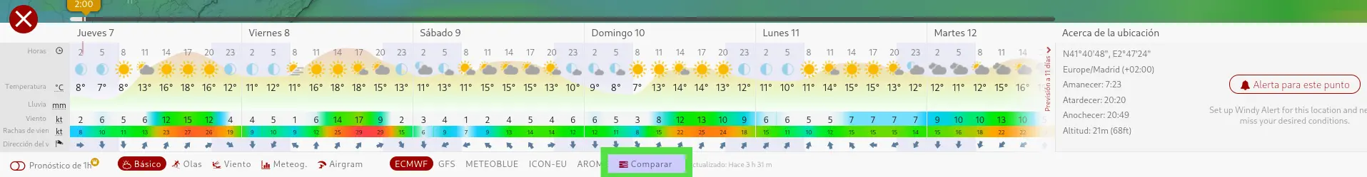
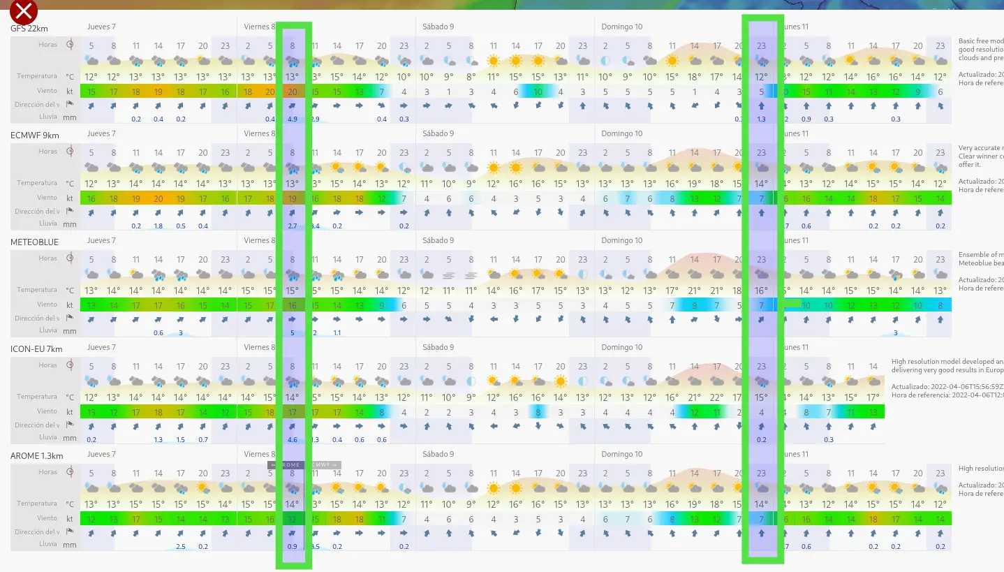
This will help us determine consensus or discrepancies among models. It’s essentially the same weather check, but seen through 4 or 5 sources, providing a broader perspective on the uncertainty levels the models hold for that specific point in time.